Organic Maps Offline Hike Bike 2024.03.31
Free Version
Publisher Description
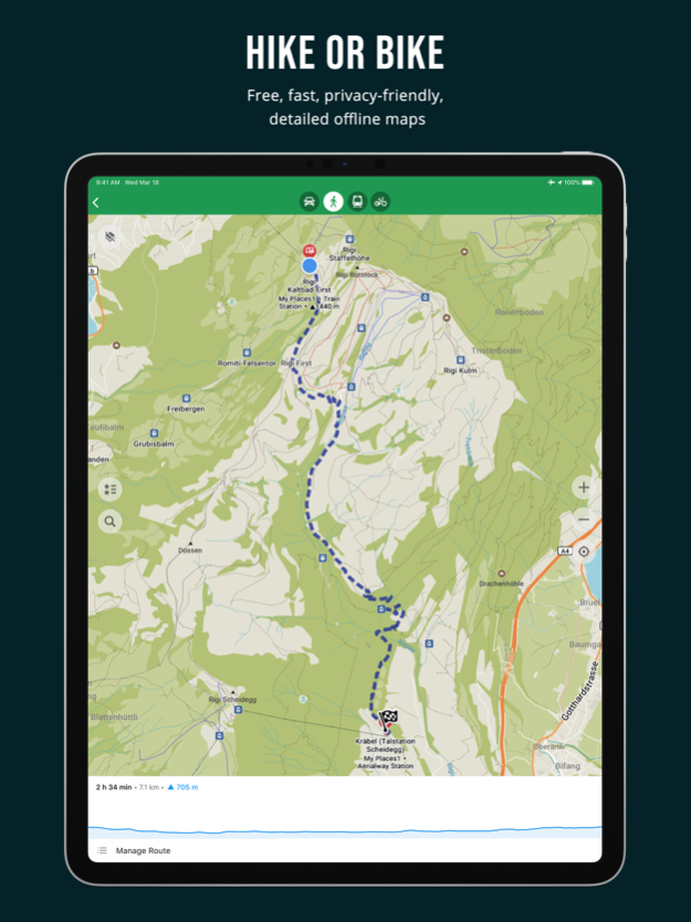
• Detailed offline maps with places that don't exist on other maps
• Cycling routes, hiking trails, and walking paths
• Contour lines, elevation profiles, peaks, and slopes
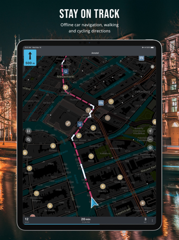
• Turn-by-turn walking, cycling, and car navigation with voice guidance
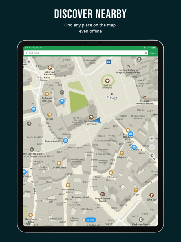
• Fast offline search
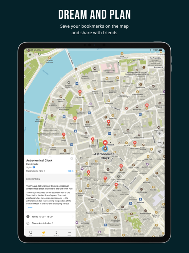
• Bookmark everything you need, import and share KML, KMZ, GPX
• Dark mode to protect your eyes
• … and many other features!
Organic Maps is pure and organic, made with love:
• Respects your privacy
• Saves your battery
• No unexpected mobile data charges
Organic Maps is free from trackers and other bad stuff:
• No ads
• No tracking
• No data collection
• No phoning home
• No annoying registration
• No mandatory tutorials
• No noisy email spam
• No push notifications
• No crapware
• No pesticides
At Organic Maps, we believe that privacy is a fundamental human right:
• Organic Maps is an indie community-driven project
• The code is open-sourced
• The maps data is taken from OpenStreetMap, also community-driven project
• We protect your privacy from Big Tech’s prying eyes
• Stay safe no matter wherever you are
Reject surveillance, embrace your freedom, and support the community.
Give Organic Maps a try!
Apr 3, 2024
Version 2024.03.31
• Better isolines elevation data for European countries, thanks to Sonny
• OpenStreetMap data as of March 26
• Bookmark lists are sorted by modification time (recent at the top)
• Eye icons for visible/hidden bookmark lists
• Distance and time do not freeze anymore in CarPlay
• Fixed wrong time and distance when switching planned route modes
• Fixed the wrong 'saved bookmark' icon
• Many new objects can be added to OpenStreetMap: various shops and crafts, BBQs, food courts, lang schools, cairns, money transfer points, etc.
• Add "wheelchair" to the search input to limit results to wheelchair-accessible
• Searchable orders pickup points (shop=outpost)
• Added a long tap back button menu
Map styling:
• Added wind turbines and power plant icons
• Reduced visibilities of many outdoors-specific POIs when in the main map style, e.g., waterfalls, mountain peaks, shelters, power towers, etc. (use the Outdoors style for those!)
• More consistent font sizes and caption appearances
Translations updates:
• Slovak, Italian, Spanish, Hindi
• Fixed police, parking, and sights category search for simplified Chinese
…and more fixes and improvements, check https://omaps.org/news for details!
About Organic Maps Offline Hike Bike
Organic Maps Offline Hike Bike is a free app for iOS published in the Recreation list of apps, part of Home & Hobby.
The company that develops Organic Maps Offline Hike Bike is Organic Maps. The latest version released by its developer is 2024.03.31.
To install Organic Maps Offline Hike Bike on your iOS device, just click the green Continue To App button above to start the installation process. The app is listed on our website since 2024-04-03 and was downloaded 1 times. We have already checked if the download link is safe, however for your own protection we recommend that you scan the downloaded app with your antivirus. Your antivirus may detect the Organic Maps Offline Hike Bike as malware if the download link is broken.
How to install Organic Maps Offline Hike Bike on your iOS device:
- Click on the Continue To App button on our website. This will redirect you to the App Store.
- Once the Organic Maps Offline Hike Bike is shown in the iTunes listing of your iOS device, you can start its download and installation. Tap on the GET button to the right of the app to start downloading it.
- If you are not logged-in the iOS appstore app, you'll be prompted for your your Apple ID and/or password.
- After Organic Maps Offline Hike Bike is downloaded, you'll see an INSTALL button to the right. Tap on it to start the actual installation of the iOS app.
- Once installation is finished you can tap on the OPEN button to start it. Its icon will also be added to your device home screen.
Program Details
General |
|
|---|---|
| Publisher | Organic Maps |
| Released Date | 2024-04-03 |
| Languages | English |
Category |
|
|---|---|
| Category | Home & Hobby |
| Subcategory | Recreation |
System requirements |
|
|---|---|
| Operating systems | ios |
Download information |
|
|---|---|
| File size | 145.12 MB |
| Total downloads | 1 |
Pricing |
|
|---|---|
| License model | Free |
| Price | N/A |
Version History
version 2024.03.31
posted on 2024-04-03
Apr 3, 2024
Version 2024.03.31
• Better isolines elevation data for European countries, thanks to Sonny
• OpenStreetMap data as of March 26
• Bookmark lists are sorted by modification time (recent at the top)
• Eye icons for visible/hidden bookmark lists
• Distance and time do not freeze anymore in CarPlay
• Fixed wrong time and distance when switching planned route modes
• Fixed the wrong 'saved bookmark' icon
• Many new objects can be added to OpenStreetMap: various shops and crafts, BBQs, food courts, lang schools, cairns, money transfer points, etc.
• Add "wheelchair" to the search input to limit results to wheelchair-accessible
• Searchable orders pickup points (shop=outpost)
• Added a long tap back button menu
Map styling:
• Added wind turbines and power plant icons
• Reduced visibilities of many outdoors-specific POIs when in the main map style, e.g., waterfalls, mountain peaks, shelters, power towers, etc. (use the Outdoors style for those!)
• More consistent font sizes and caption appearances
Translations updates:
• Slovak, Italian, Spanish, Hindi
• Fixed police, parking, and sights category search for simplified Chinese
…and more fixes and improvements, check https://omaps.org/news for details!
version 2024.03.07
posted on 2024-03-08
Mar 8, 2024
Version 2024.03.07
• OpenStreetMap data as of February 28
• Export all bookmarks as a single KMZ file
• Allow changing the track color
• New about screen
• Fixed several crashes
• Updated the primary app color
• Replaced Night Mode with Appearance settings
• "Routing options enabled" is no longer displayed when using ruler
• Included wheelchair accessibility information on place pages
• Added recycling and elevation information to search result descriptions
…and more fixes and improvements, check https://omaps.org/news for details!
version 2024.02.06
posted on 2024-02-07
Feb 7, 2024
Version 2024.02.06
• OpenStreetMap data as of February 2
• Removed "Continue detecting your location?" dialog, now location search can be stopped by pressing the "rotating radar" location button
• Auto Light/Dark theme setting is synced with the system
• Improved the look of search bars
• Properly display a longer cuisines list
• Fixed location services permissions request for the first app start
• Reduced the height of the top navigation bar with the next street name in it
• Restroom emoji for places with toilets
• Display parking operator
• More precise turn notifications for small distances
• Fixed absent speed limit on some speed cameras
• Plus codes search shows results relative to position and to the screen center
• Fixed crash in search
• Better and more precise search on the map, more relevant search results in the list
• Name editing for playgrounds
• Parse mlat and mlon parameters from OSM urls
• Allow editing Greek names for Cyprus
• Hindi support
Map styles:
• Orange color for secondary roads
• Wider and brighter white tertiary roads
• Nicer looking on- and off-ramp road links joins
• Raised visibility of secondary and tertiary road links
• Less bright farmlands color
• Smaller mountain passes/saddles icons
• Reduced visibilities of mountain saddles (compared to passes)
• New ford icon
• Made hospital and clinic icons look different
• Reduced visibility of light rail stations
• Added Boston and updated Taipei subway icons
• Fixed Delhi subway entrance icons, Minsk & Spb subway captions on detailed zoom
• Increased font size of towns and suburbs labels and decreased for neighborhoods
• Fixed bookmark icon for water parks
• Adjust visibilities of many POIs
Outdoors map style:
• Increased 50m & 100m contour lines visibilities
• Raised visibility of campsites, survey points, toilets, touristic information features
• New power tower and flagpole/mast icons
• Made bridleways to be the same brown color as paths
• Increased contrast of footways on overview zooms
Car navigation map style:
• Added toilets, convenience stores
• Reduced visibilities of artwork features and subway station captions
• Bigger roundabout exit number
Updated Catalan, Chinese, Czech, Finnish, French, Romanian, Slovak, Ukrainian translations
…and more fixes and improvements, check https://omaps.org/news for details!
version 2024.01.09
posted on 2024-01-10
Jan 10, 2024
Version 2024.01.09
• Copy place title, address, coordinates and other information using a long tap
• CarPlay: support touch panning gestures
• Add Notes section to the 'Add place to OpenStreetMap' screen
• OpenStreetMap map data as of January 5
Styles:
• Added cairns, updated Singapore subway icon
• Slightly increased contrast of lines on the World overview map
• Make secondary roads a bit brighter than tertiary/etc.
• Car navigation style: fixed some footways/paths/tracks being displayed too early as white dashed lines
• Main style: fix color of footways with a sac_scale=* tag to be same as path
• Fixed very thin lines (e.g. tram lines) having inconsistent transparency/contrast between different devices (driver•dependent)
• Fix bookmarked children playground icon
• remove labels and decrease visibility of footway crossings and sidewalks
• tuned contrast of altitude contour lines
• crisper looking lines (no edge blur)
Outdoors style:
• more contrast•looking paths, tracks, cutlines, rivers, ditches, railways, cycleways, fences, etc.
• reduce visibility of small streams and canals
• increase visibility of fences, walls and ditches
• increase visibilities of bridle/cycle/foot•ways and steps, increase label sizes
• make bridleways to be the same brown color as paths but with longer dashes
Pistes improvements:
• add snow parks and new piste types: skitour, winter hike, connection
• color freeride pistes in yellow•orange, consider ungroomed downhill runs as freeride
• better piste names and numbers/refs support
• in Outdoors style: increase pistes visibilities and display detailed piste shapes (area fills)
Other:
• Display capacity of parkings, bicycle docks and charging stations when they're selected
• Adjust shop, amenity, leisure ranking in the search
Translations:
• new Azebaijani language
• updates to Chinese, Polish, Hebrew, Romanian
…and more smaller fixes and improvements, check https://omaps.org/news for details!
version 2023.12.22
posted on 2023-12-24
Dec 24, 2023
Version 2023.12.22
We have prepared several Christmas/New Year presents for you:
• Outdoors map style for hiking, cycling, and exploring the Nature
• Search for village addresses without streets in Austria, Czechia, Germany, Poland, Slovakia and some other countries
• Type "skiing" or "ski run" in the search to find downhill and Nordic pistes
• OpenStreetMap map data as of December 13
• Added a button to see photos, reviews, and prices for some hotels. Every booking made through the app contributes to the development of the project!
Other notable fixes and improvements:
• Fixed several crashes and freezing on iOS 12, 13, 14
• Multiple KML files can be imported from a single KMZ file
• Less "gaps" in highways on the World map
• Removed very short ferry lines from the World map
• A credit card is displayed for selected places with ATM
• A dollar emoji is displayed where a fee is required
• Prettified websites in Place Page
• "Zoom in to see isolines" message does not cover buttons
• CarPlay Search button now properly shows search results
• Improved user interface for the Search on iPad
Styles
• Singapore metro icon
• Added Hackerspace
• Fixed Porto metro icon
• Fixed residential leisure garden area fills disappearing on some zoom levels
• Display house numbers regardless of buildings' sizes
• Fine-tuned visibility of many objects in the main style
Translations
• Improved Chinese, Dutch, Finnish, Polish, Russian translations
• Added Dutch, French, Polish, Romanian, and Russian translations for a place's Business Hours editing instructions
• Fixed missing parking translations
…and more smaller fixes and improvements, check https://omaps.org/news for details!
version 2023.12.20
posted on 2023-12-21
Dec 21, 2023
Version 2023.12.20
We have prepared several Christmas/New Year presents for you:
• Outdoors map style for hiking, cycling, and exploring the Nature
• Search for village addresses without streets in Austria, Czechia, Germany, Poland, Slovakia and some other countries
• Type "skiing" or "ski run" in the search to find downhill and Nordic pistes
• OpenStreetMap map data as of December 13
• Added a button to see photos, reviews, and prices for some hotels. Every booking made through the app contributes to the development of the project!
Other notable fixes and improvements:
• Fixed several crashes and freezing on iOS 12, 13, 14
• Multiple KML files can be imported from a single KMZ file
• Less "gaps" in highways on the World map
• Removed very short ferry lines from the World map
• A credit card is displayed for selected places with ATM
• A dollar emoji is displayed where a fee is required
• Prettified websites in Place Page
• "Zoom in to see isolines" message does not cover buttons
• CarPlay Search button now properly shows search results
• Improved user interface for the Search on iPad
Styles
• Singapore metro icon
• Added Hackerspace
• Fixed Porto metro icon
• Fixed residential leisure garden area fills disappearing on some zoom levels
• Display house numbers regardless of buildings' sizes
• Fine-tuned visibility of many objects in the main style
Translations
• Improved Chinese, Dutch, Finnish, Polish, Russian translations
• Added Dutch, French, Polish, Romanian, and Russian translations for a place's Business Hours editing instructions
• Fixed missing parking translations
…and more smaller fixes and improvements, check https://omaps.org/news for details!
version 2023.12.13
posted on 2023-12-14
Dec 14, 2023
Version 2023.12.13
• New OpenStreetMap data as of November 13, 2023
• Fixed crash on iOS 12, 13 and 14 when selecting any object on the map
• It is possible to zoom in deeper now and see more POIs in dense areas
• Outdoors map style preview (please read on to know how to activate it)
• Removed bottom tab bar to show more map on the screen
• Removed the unnecessary "route" button on the map (tap or long-tap a place on the map or select a search result to build a route using the "Route To" button instead)
• Highlighted the Route To button and hinted the FAQ for new users
• Fixed CarPlay dark/light mode colors
• Fixed keyboard input on iPadOS 15+
• "Inertial" kinetic scroll improvements
• Removed max limit to search bookmarks
• Brands are displayed in the Place Page
Routing
• Don't route through access=emergency, military, agricultural, forestry
• Tuned ferry crossing estimations
• Improved cross-country and cross-region routing
• Improved residential routes
Search
• Process platz-pl like strasse-str
• Improved address matching
• Improved search of brands
Map styling
• Added flowerbeds, rental shops, bicycle rentals, motorcycle repairs, petting zoo, prison areas, compressed air
• Added nature reserves and military zones rendering to the car navigation mode
• Added Docklands Light Railway, Porto metro
• Display names of ski pistes
• Tuned/updated icons of fitness centre, yoga, theatre, artwork, statue, theme park, bbq, lighthouse, windmill, heliport & helipad, hunting stand, Kingdom Hall of Jehovah's Witnesses, paid & private versions of parkings and parking entrances, convenience / deli / farm / grocery / health_food shops, tobacco shop
• Better farmyard & garage landuse area fills
• Increased scrubs, alpine huts visibility
• Updated sanitary dump station icons and adjusted its priority
• Reduced visibility of cave entrances and improved the icon
• Increased visibility of standalone house numbers
• Reduced Tokyo subway visibility
• Removed minor road markers/shields cluttering the map in Estonia
• Fix colors of Estonia and Germany road markers / shields
• Increased visibilities of road markers / shields on tertiary and residential road
• Fixed "gaps" in some densely mapped lines
• Fixed "gaps" in the outlines of bridges and other compound lines
Outdoors map style preview:
• Tailored for out-of-the-city outdoor activities like hiking, backcountry cycling/MTB, 4x4, etc.
• Emphasizes paths/tracks, cliffs, railways, powerlines, rivers and streams, water sources, peaks, mountain saddles and passes, waterfalls, lighthouses, caves, viewpoints, campsites, huts, shelters, picnic sites, gates, stiles, fords, etc.
• Enable by typing `?olight` in the search field and return to the map; type `?light` to switch back to the main style
• Use `?odark` and `?dark` for a dark style
• Developers wanted to add a nice UI for style switching!
Translations
• Improved "avoid …" routing options wording
• Improved Arabic, Basque, Chinese, Czech, Danish, Finnish, Greek, Hungarian, Indonesian, Italian, Korean, Marathi, Polish, Romanian, Slovak, Spanish, Sweden, Thai, Turkish, Ukrainian, and Vietnamese translations
…and more smaller fixes and improvements, check https://omaps.org/news for details!
version 2023.11.17
posted on 2023-11-21
Nov 21, 2023
Version 2023.11.17
• New OpenStreetMap data as of November 13, 2023
• It is possible to zoom in deeper now and see more POIs in dense areas
• Outdoors map style preview (please read on to know how to activate it)
• Removed bottom tab bar to show more map on the screen
• Removed the unnecessary "route" button on the map (tap or long-tap a place on the map or select a search result to build a route using the "Route To" button instead)
• Highlighted the Route To button and hinted the FAQ for new users
• Fixed CarPlay dark/light mode colors
• Fixed keyboard input on iPadOS 15+
• "Inertial" kinetic scroll improvements
• Removed max limit to search bookmarks
• Brands are displayed in the Place Page
Routing
• Don't route through access=emergency, military, agricultural, forestry
• Tuned ferry crossing estimations
• Improved cross-country and cross-region routing
• Improved residential routes
Search
• Process platz-pl like strasse-str
• Improved address matching
• Improved search of brands
Map styling
• Added flowerbeds, rental shops, bicycle rentals, motorcycle repairs, petting zoo, prison areas, compressed air
• Added nature reserves and military zones rendering to the car navigation mode
• Added Docklands Light Railway, Porto metro
• Display names of ski pistes
• Tuned/updated icons of fitness centre, yoga, theatre, artwork, statue, theme park, bbq, lighthouse, windmill, heliport & helipad, hunting stand, Kingdom Hall of Jehovah's Witnesses, paid & private versions of parkings and parking entrances, convenience / deli / farm / grocery / health_food shops, tobacco shop
• Better farmyard & garage landuse area fills
• Increased scrubs, alpine huts visibility
• Updated sanitary dump station icons and adjusted its priority
• Reduced visibility of cave entrances and improved the icon
• Increased visibility of standalone house numbers
• Reduced Tokyo subway visibility
• Removed minor road markers/shields cluttering the map in Estonia
• Fix colors of Estonia and Germany road markers / shields
• Increased visibilities of road markers / shields on tertiary and residential road
• Fixed "gaps" in some densely mapped lines
• Fixed "gaps" in the outlines of bridges and other compound lines
Outdoors map style preview:
• Tailored for out-of-the-city outdoor activities like hiking, backcountry cycling/MTB, 4x4, etc.
• Emphasizes paths/tracks, cliffs, railways, powerlines, rivers and streams, water sources, peaks, mountain saddles and passes, waterfalls, lighthouses, caves, viewpoints, campsites, huts, shelters, picnic sites, gates, stiles, fords, etc.
• Enable by typing `?olight` in the search field and return to the map; type `?light` to switch back to the main style
• Use `?odark` and `?dark` for a dark style
• Developers wanted to add a nice UI for style switching!
Translations
• Improved "avoid …" routing options wording
• Improved Arabic, Basque, Chinese, Czech, Danish, Finnish, Greek, Hungarian, Indonesian, Italian, Korean, Marathi, Polish, Romanian, Slovak, Spanish, Sweden, Thai, Turkish, Ukrainian, and Vietnamese translations
…and more smaller fixes and improvements, check https://omaps.org/news for details!
version 2023.09.22
posted on 2023-09-25
version 2023.09.01
posted on 2023-09-04
Sep 4, 2023
Version 2023.09.01
Hotfix for invisible imported GPX trails
• New OpenStreetMap maps data as of August 14
• Updated more than a year old Wikipedia articles
• Fixed Wiki text in the dark mode
• Added missing isolines for some regions of Argentina, Chile, Kazakhstan, Tibet, USA, Russia (map sizes increased)
• More dense isolines in many areas
• Reduced many other map sizes
• Import comments from GPX cmt tag
• Treat GPX track segments as part of the singular track they belong to
• Fixed a bug when editing social contacts
• Dog Park can be added in the Editor
• Updated Persian voice directions
Routing
• Updated road surface factors for car routing profile
• Better pedestrian routing in Turkey and Georgia
• Fixed cross-region routing when "avoid" options are enabled
Search
• Fixed search for addresses in Czech and Slovakia
• Improved street matching
• Remove Tourist Information, Place of Worship, Park, Information Board, and Tourist Map from the Sightseeings category
• Do not filter duplicated search results except of very close bus stops
• Better ranking when searching by category
• Fixed search by a house name
Styles
• Added ferry routes to the World map
• Removed square background from parking icons
• Added separate icons for paid and private parkings
• Made bicycle parking icon differ more from the motorcycle one
• Updated parking entrance icon
• Street-side and lane parkings use a smaller icon and appear later when zooming in
• Added a motorcycle parking and parking entrance icons to the navigation mode
• Fixed motorway=trunk links visibility in navigation mode
• Improved motorway=trunk colors
• Removed too small isolines at overview zoom levels
• Added Tehran metro icon
• Revamped priorities system, especially for POIs
• Many other fixes and enhancements
Follow our news at https://omaps.org/news
version 2023.08.18
posted on 2023-08-21
Aug 21, 2023
Version 2023.08.18
• New OpenStreetMap maps data as of August 14
• Updated more than a year old Wikipedia articles
• Fixed Wiki text in the dark mode
• Added missing isolines for some regions of Argentina, Chile, Kazakhstan, Tibet, USA, Russia (map sizes increased)
• More dense isolines in many areas
• Reduced many other map sizes
• Import comments from GPX cmt tag
• Treat GPX track segments as part of the singular track they belong to
• Fixed a bug when editing social contacts
• Dog Park can be added in the Editor
• Updated Persian voice directions
Routing
• Updated road surface factors for car routing profile
• Better pedestrian routing in Turkey and Georgia
• Fixed cross-region routing when "avoid" options are enabled
Search
• Fixed search for addresses in Czech and Slovakia
• Improved street matching
• Remove Tourist Information, Place of Worship, Park, Information Board, and Tourist Map from the Sightseeings category
• Do not filter duplicated search results except of very close bus stops
• Better ranking when searching by category
• Fixed search by a house name
Styles
• Added ferry routes to the World map
• Removed square background from parking icons
• Added separate icons for paid and private parkings
• Made bicycle parking icon differ more from the motorcycle one
• Updated parking entrance icon
• Street-side and lane parkings use a smaller icon and appear later when zooming in
• Added a motorcycle parking and parking entrance icons to the navigation mode
• Fixed motorway=trunk links visibility in navigation mode
• Improved motorway=trunk colors
• Removed too small isolines at overview zoom levels
• Added Tehran metro icon
• Revamped priorities system, especially for POIs
• Many other fixes and enhancements
Follow our news at https://omaps.org/news
version 2023.07.13
posted on 2023-07-14
Jul 14, 2023
Version 2023.07.13
• Fresh OpenStreetMap data as of July 10, 2023
• Support altitude, OsmAnd and Garmin colors in imported GPX tracks
• Show coordinates in Open Location Code (OLC), UTM, MRGS, and OpenStreetMap.org formats on click and copy coordinates on a long tap
• Fixed crash when rendering large objects
• Bookmark lists descriptions are now displayed and saved properly
• Faster loading of bookmarks and tracks
• Fixed pedestrian ETA for big slopes
• Prefer tertiary roads to service roads in car routing
Search
• Improved search results ranking
• Fixed shop categories search
• Fixed airport search results with empty names
Styles
• Improve visibility and findability of highway services and rest areas
• Added second-hand category, auction, collectors shops, turnstile & exit
• Fixed underwater tunnels not being visible
• Fixed areal water tunnels being drawn over other areas
• Major railway lines are more visible now, while minor utility/service tracks clutter the map less
• Fixed railway-abandoned/preserved bridges
• Added a bridge structure outline man_made-bridge
• Added community center, conference center, exhibition center, events venue
• Increased shop icons priority
• Added boundary=protected_area
Translations:
• Updated Catalan, Czech, Finnish, French, German, Italian, Polish, Spanish, Swedish, and Turkish translations
Follow our news at https://omaps.org/news
version 2023.06.04
posted on 2023-06-07
Jun 7, 2023
Version 2023.06.04
• GPX import support
• New OpenStreetMap data as of June 2, 2023
• Fixed disappearing bookmark lists when wrong characters were saved in a bookmark name or description
• Improved car and bicycle routing
• Fixed non-working Portuguese (Brazil) and Spanish (Mexico) voice directions languages
• Fixed crash when importing KML/KMZ/GPX file
• Fixed repeated imports of the same file
• Corrected Basque, Belarusian, British, English, and Ukrainian translations
Styles:
• Fixed funicular icon
• Changed desert color in the dark mode
• Added Fish Pass
• New Icon for Parcel Locker
• Fixed icon for northernmost Munich underground station
Follow our news at https://omaps.org/news
version 2023.05.08
posted on 2023-05-10
May 10, 2023
Version 2023.05.08
• New OpenStreetMap data as of May 3
• Implemented search for interpolated odd/even house numbers
• Faster rendering of subway layer
• Fixed wrong postcodes in Paris
• Fixed missing Wikipedia links
• Fixed car routing via roundabouts
• Improved English, German, and Brazil translations
• Enabled TTS for Basque, Marathi, Norwegian, Portuguese (Brazil), Spanish (México)
• Added camera shop, interior_decoration, antiques, art, cheese shop
• Changed gate icon
• Changed the Lyon subway icon
• Fixed US road shields
• Fixed priority of water areas
Follow our news at omaps.org/news
version 2023.04.02
posted on 2023-04-04
Apr 4, 2023
Version 2023.04.02
• New OpenStreetMap data as of March 29
• Navigation directions are now correctly displayed on iPad
• Replaced uphill and downhill icons with more clear arrows
• Correctly import KML bookmarks with track data
• Disable 3D buildings preference if power saving is enabled
• Music and music instruments shops can be added using Editor
• Sewing shops and haberdasheries are searchable and have a better icon
• Searching for a "supermarket" doesn't result in convenience stores anymore
• Add localized links for the OSM wiki page
Styles
• New shop types: agrarian, appliance, bed, outpost, gas, key cutter, locksmith, carpet, motorcycle repair, pet grooming, hi-fi, bathroom furnishing, curtain, fashion accessories, cannabis, herbalist
• Added money transfer, bicycle charging stations, power plant
• Made captions optional for most of POI icons
• Made park, forest, and scrub colors different
• Added metal construction icons
• Improved aerial ways, cable cars, power lines, fences
• Reduce Barcelona subway visibility
• Fixed isolines that are drawn over buildings, roads, etc.
• Fixed rendering of multiple-type features (e.g. some POI captions were displayed too early)
Translations:
• Improved German, Turkish, Belarusian, Hungarian translations
• Improved Arabic TTS instructions
Follow our news at omaps.app/news
version 2023.03.02
posted on 2023-03-02
Mar 2, 2023
Version 2023.03.02
• New OpenStreetMap data as of February 27
• Fixed freeze on iPad when a keyboard is connected
• Fixed unnecessary double click on the route button
• Removed duplicated floors and zip code cells
• Enabled OpenStreetMap editor notes for all selected places
• Fixed and improved search
• Split vegan and vegetarian cuisines in search
• Fixed styles for airports, land uses, waterways, and hatching fill areas
• Some smaller areas are not obscured by large ones anymore
• Added healthcare specialists: alternative, audiologist, blood_donation, optometrist, podiatrist, psychotherapist, sample_collection, speech_therapist
• Added communication towers, loading docks, solar, wind, gas, and hydropower generators
• Fixed the Bilbao metro icon
• Historic ruins can now be added in the Editor
• Improved Arabic, Norwegian, Portuguese, and Turkish translations
Follow our news at omaps.app/news
version 2022.07.27
posted on 2022-07-28
Jul 28, 2022 Version 2022.07.27
• New OSM data as of July 18
• Show "Open"/"Opens in"/"Closes in" in search results
• Added missing shop types from top OSM tags: antiques, art, baby_goods, bag, boutique, charity, cheese, craft, dairy, deli, electrical, farm, fishing, grocery, health_food, houseware, interior_decoration, kitchen, lottery, medical_supply, nutrition_supplements, paint, pastry, perfumery, second_hand, sewing, storage_rental, tobacco, trade, watches, wholesale
• Show speed limit near the current speed in navigation mode
• Properly select max speed in some routing cases
• sport=* tags have higher priority than leisure=pitch
• Fill transit mark place page with feature info
• Show text info about the next turn's street longer
• Use building:min_level for 3D buildings
• Allow removing cuisines from selection in the Editor
• Fix Belarusian, German, Russian, Ukrainian translations
• Add missing translations for OSM natural=* and amenity=events_venue types
version 2022.04.26
posted on 2022-04-29
Apr 29, 2022 Version 2022.04.26
• New OSM data as of April 15, 2022
• Added Wikipedia articles for many objects (experimental)
• Improved car route directions
• Some speed and battery optimizations
• Many routing improvements
• Fixed subway routing in some cities
• Added Euskara (Basque) translations
• Improved Italian and DE translations
• Draw oneway arrows more often
• Removed town halls and gardens from sightseeing
• Use phone from "mobile" OSM tag
• Added more vending_machine types
• Added landuse=education
• Orange fill for school, kindergarten and landuse=education areas
• Fixed Recycling category search
• Fixed Internet access displaying
• Fixed descriptions serialization in the edits.xml
• Fixed font rendering
• Follow our news in "?" dialog
version 2022.03.23
posted on 2022-03-24
Mar 24, 2022 Version 2022.03.23
• New OSM data as of March 14, 2022
• Display Wikipedia articles for well-known places
• Fixed appearance of date pickers when editing opening hours
• Fixed rare crashes after downloading maps
• Select a proper light/dark CarPlay theme on the startup
• Automatically switch CarPlay dark/light mode based on the system notification
• Add date and time to My Position bookmarks
• Fixed crash on the menu click after hiding the interface
• Search for organic shops and restaurants!
• Brighter roads in night mode
• Darker farmlands and parking areas
• Properly display parkings and parks over hospital grounds
• Synced visibility for steps and footways
• Fixed visibility of community_centre
• Added bubble_tea
• Removed transparent circles from some icons
• Fixed museum icons
• Improved routing algorithm
• Improved Arabic, Romanian and Spanish translations
version 2022.01.12
posted on 2022-01-14
Jan 14, 2022 Version 2022.01.12
• New OSM maps data as of January 3, 2022
• Improved search results ranking
• Fixed hundreds of "capitals" on the World map
• Fixed invalid inter-region routes
• Search recognizes rd as road, st as street, ct as court synonyms
• Consistent naming for Bookmark Lists
• Added Belarusian, Persian, incomplete Hebrew, and Swahili translations
• Updated German, Italian, Romanian, Russian, Ukrainian, Turkish translations
version 2021.12.01
posted on 2021-12-02
Dec 2, 2021 Version 2021.12.01
• New OSM maps data as of November 22
• Fixed routing between map regions, please test and report to us any issues!
• Type "water" or "drinking water" in search to find it around yourself
• Fixed opening of https://omaps.app/ and om:// links on the cold start
• Updated Russian, Finnish, German, French, Spanish, Ukrainian, Belarusian and Chinese translations
